A surge of cool air will arrive across the northern Plains during the weekend and expand to cover much of the eastern half of the U.S. by the middle of next week. Hot, dry weather will persist, however, across northern California and the Northwest, and develop in the south-central U.S.
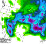
Meanwhile, the interaction between the Southwestern monsoon circulation and several cold fronts will lead to “ring of fire” showers in an arc across the Four Corners States, the central Plains, the middle Mississippi Valley, and the Southeast, with 5-day rainfall totals reaching 1 to 3 inches in many locations.
Continue reading A favorable pattern shift ahead for the Heartland at Brownfield Ag News.