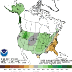
High pressure building southward from eastern Canada will maintain mostly sunny skies across the eastern third of the nation while deflecting Hurricane Humberto out to sea. The high will bring below-normal temperatures to the East Coast States, whereas southerly flow on the backside of the high maintains very warm weather (temperatures averaging 10° or more above normal) from the Plains into the Corn Belt.
Meanwhile, a weak tropical disturbance over the northwestern Gulf of Mexico will move ashore, producing locally heavy downpours in southeastern Texas, where 5-day rainfall totals could top 6 inches.
Continue reading Favorable warmth to yield to rains across the Heartland at Brownfield Ag News.
