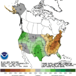
Around mid-week, a batch of wintry precipitation will quickly spread from the Midwest into the Northeast. Meanwhile, Southeastern rain will largely end by Thursday, when a new storm system will begin to emerge from the western U.S.
Late-week precipitation in the nation’s mid-section will include snow across the northern Plains and upper Midwest, and rain from the southern Plains into the mid-South. During the weekend, precipitation will continue to spread eastward from the Mississippi Valley to the Atlantic Seaboard; significant weekend snow could accumulate in the Northeast.
Continue reading Much colder pattern ahead across the Heartland at Brownfield Ag News.
