SIOUX FALLS, S.D. — Winter made its first official appearance over the weekend as a widespread snow system blanketed much of the Tri-State area with the season’s first measurable accumulation.
The storm, which developed after midnight Friday and tracked southeast through the day, dropped between 1 and 5 inches across eastern South Dakota, southwest Minnesota, and northwest Iowa. The snow came down heavily at times, with rates of up to one inch per hour reported during the mid-morning hours.
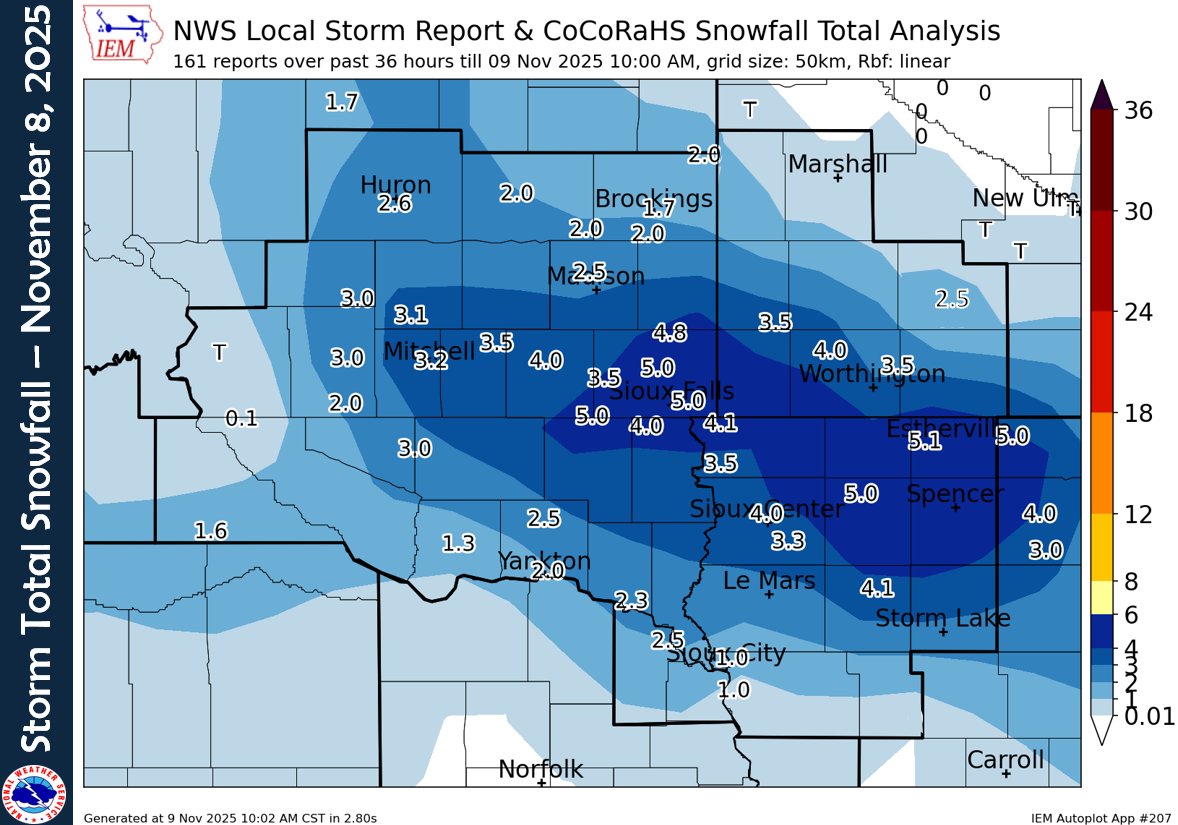
According to the National Weather Service in Sioux Falls, the highest totals centered around the Sioux Falls metro area and nearby counties. Parker in McCook County led local reports with 5 inches, while Sioux Falls and Spencer, Iowa, each picked up between 4.5 and 5 inches.
Other totals included 3.5 inches in Mitchell, 3.2 inches in Huron, and 2.6 inches in Madison. To the south, Yankton reported around 3 inches, with lighter amounts near the Nebraska border.
In Iowa, Estherville and Sanborn each recorded 5 inches, while Worthington, Minnesota, measured 3 to 4 inches.
The snow was followed by a sharp drop in temperatures and gusty winds, causing minor drifting and slick travel conditions Saturday night into Sunday morning. Overnight lows plunged into the teens across the region.