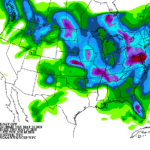
A pair of disturbances — one currently over the east-central Plains and the other in the northern Great Lakes—will march east, with the northern system weakening while the southern low stalls upon reaching the Mid-Atlantic Coast. The two will combine to produce widespread showers in lower portions of the Corn Belt and Ohio Valley and from the Mid-Atlantic into the Northeast, with the latter regions susceptible to potentially heavy rain and localized flash flooding over the weekend.
Continue reading Rain pattern winding-down across the Corn Belt at Brownfield Ag News.